


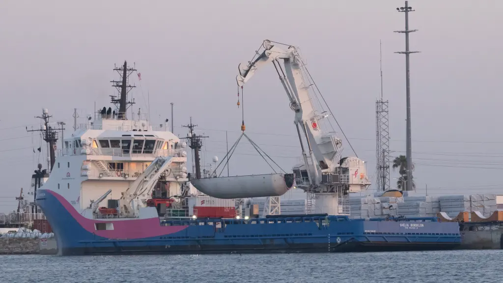
Featured image credit: SpaceX
Lift-Off Time | December 16, 2022 – 11:46:47 UTC | 3:46:47 PST |
|---|---|
Mission Name | SWOT, Surface Water and Ocean Topography |
Launch Provider | SpaceX |
Customer | National Aeronautics and Space Administration (NASA) Centre National d’Études Spatiales (CNES) Canadian Space Agency (CSA) United Kingdom Space Agency (UKSA) |
Rocket | Falcon 9 Block 5, Booster B1071-6 |
Launch Location | Space Launch Complex 4E (SLC-4E), Vandenberg Space Force Base, in California, USA |
Payload mass | ~2,200 kg (4,850 lb) |
Where did the spacecraft go? | To a 891 km (554 mi) low-Earth polar orbit (LEO) at a 77.6° inclination; initially, 857 km (533 mi) x 77.6° |
Did they attempt to recover the first stage? | Yes |
Where did the first stage land? | It landed at Landing Zone 4 (LZ-4), about 425 m (1,395 ft) from the launch complex at Vandenberg Space Force Base |
Did they attempt to recover the fairings? | Yes, by NRC Quest at about 433 km (269 mi) downrange |
Were these fairings new? | TBD |
This was the: | –200th SpaceX mission –57th SpaceX flight of 2022 –190th Falcon 9 flight –56th Falcon 9 flight of 2022 –179th orbital launch attempt of 2022 |
Where to watch | Official livestream |
How Did It Go?
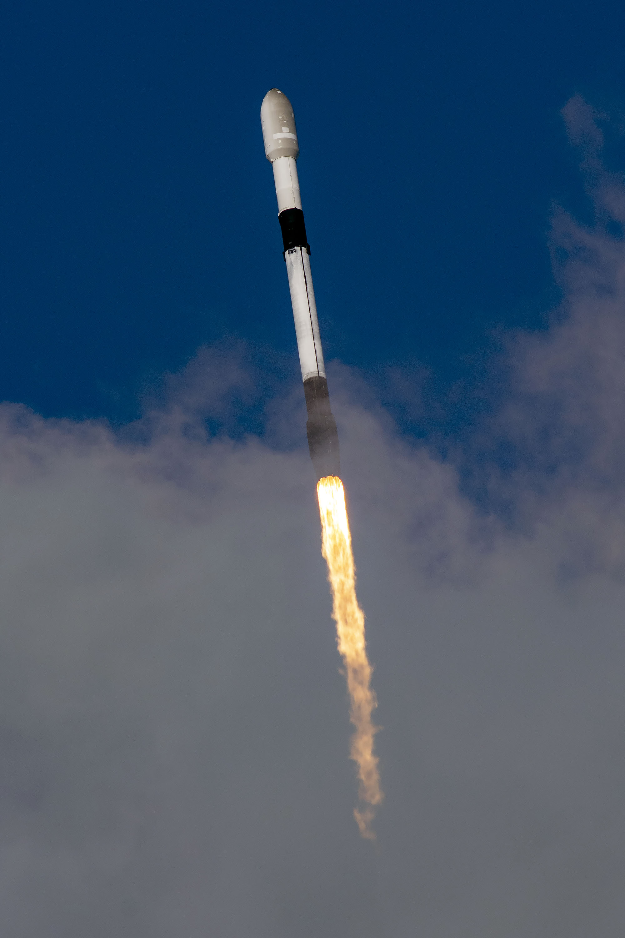
SpaceX successfully launched a Falcon 9 Block 5 rocket transporting an Earth observation satellite in a mission known as Surface Water and Ocean Topography (SWOT) both for NASA and for CNES. Lift-off took place from the Space Launch Complex 4E (SLC-4E), at Vandenberg Space Force Base, in California, USA. This Falcon 9 performed a massive dogleg maneuver, starting its flight due southwest, to end up flying heading southeast. SpaceX’s vehicle placed the satellite in a 845 km polar orbit at 77.6° inclination. From there, the spacecraft will later climb to its final destination at 891 km in altitude, where it will operate. After the flight, the company successfully recovered the first stage.
What Is Surface Water And Ocean Topography (SWOT)?
In a joint effort from the National Aeronautics and Space Administration (NASA) and the Centre National d’Études Spatiales (CNES) — France’s space agency — the Surface Water and Ocean Topography (SWOT) mission was born. For the first time, a spacecraft will study almost the whole of the water present on the surface of the Earth. This is to say, the satellite will observe our planet, focusing on rivers, lakes, seas, and oceans, studying levels and currents. In doing so, it will gather data, which will then help researchers back on Earth to better understand on a global scale the cycle — among other things — of this precious, limited resource.
History And What’s To Come
A series of previous missions have been providing researchers with data on surface water. SWOT comes as a continuation in an uninterrupted cooperation between NASA and CNES, with other partners joining on the way. Among these, it is possible to list NOAA, EUMETSAT and ESA.
Kicking off the mentioned collaboration, the mission TOPEX/Poseidon in 1992 allowed for measuring ocean surface topography with unprecedented precision, and forecasting El Niño in 1997/1998. This was a joint NASA/CNES effort, as was the follow-on mission Jason-1 in 2001. Extending ocean topography into the 21st century, the latter further increased our understanding of ocean circulation, as well as improved climate forecasting.
OSTM/Jason-2 saw the addition of another two partners: EUMETSAT and NOAA. Launched in 2008, it continued with its predecessor’s tasks, while trying to improve in measurement precision. Spacecraft operation was handed over from CNES to NOAA and EUMETSAT. In 2016 and in the same spirit, came Jason-3, aiming to continue with the work done with this series of satellites, and improving once again in measurement precision.
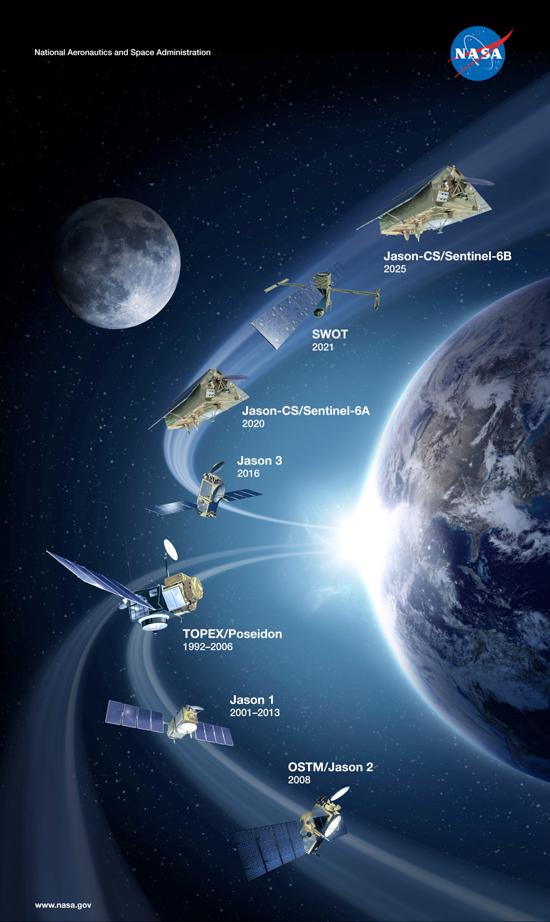
Finally, Jason-CS/Sentinel-6 “Michael Freilich” reached orbit in 2020 increasing by one the list of partners with the European Space Agency (ESA). CS stands for “Continuity of Service,” which clearly explains what this satellite was intended to do. In addition to extending the program through at least 2030, this spacecraft incorporated a Global Navigation Satellite System Radio Occultation (GNSS-RO) instrument. Such an atmosphere probing technique will allow for further weather forecasting capabilities.
A second Sentinel-6 satellite is expected to be launched in 2025, adding to the legacy of this continued cooperation. However, before that comes the present SWOT mission.
Better Understanding The SWOT Mission
Together with NASA and CNES, both the Canadian Space Agency (CSA) and the United Kingdom Space Agency (UKSA) are adding their efforts. These new partners have contributed in terms of founding, but also of components for some of the instruments flying on this mission.

SWOT will be about two scientific communities: physical oceanography and hydrology, which will benefit from the qualities of the KaRIN instrument — the main payload on this satellite. Its implementation will bring about the innovative use of swath altimeters, in contrast to the previous ones used: profile altimeters. Thus, it is possible to say that larger areas will be covered in each observation, but also with greater accuracy.
By means of this instrument, along with others that will significantly contribute, the scientists expect to carry out a series of tasks, described in the following subsections. As a clarification, it is worth stressing that from these come the satellite’s design requirements.
Oceanography
A number of oceanic phenomena take place at scales between 15 km (9.3 mi) and 200 km (124 mi), which are smaller than what present instruments in orbit are capable of seeing. Exchange of both heat and carbon, between the oceans and the atmosphere, is greatly determined by currents and fronts.The former mean water moving from one place to another, or in closed loops — these are named eddies — the latter are masses, or extensions of this liquid featuring different characteristics — density, temperature, salt content, among others. All of these processes have an influence on climate change, making it very desirable that SWOT observed and studied them.
Close to the coasts, events take place at another scale: currents and tides happen in smaller regions, over shorter time periods. Because of this, SWOT will not be able to study them instant after instant, though its greater-detail swath observations will deepen the understanding of their physical configurations. Detailed measuring — including wave’s height — will also help to separate ocean behaviors because of tides from those because of currents. Telling these apart could not be possible through previous conventional altimetry, but it will now aid with coastal navigation and help understand ocean mixing.
Hydrology
On this side of science, the French-US spacecraft will make an inventory of surface water bodies in land regions with an area of at least 250 m2 (2,691 ft2), measure water stored in them and its change with time, as well as determine how much of it is flowing through rivers — 100 m (328 ft) or more in width — at different times.
Thanks to SWOT’s measurements, researchers will be able to assess how much fresh water is flowing to and from places where it is stored, e.g. lakes, reservoirs, or others. Further cases of interest are floodplains and wetlands, where the actual amount of water flowing is essentially unknown. By determining this, it will be possible to understand how water moves from one place to another, or how it regulates the carbon exchange with the atmosphere in those regions.
What is more, many reservoirs store vast amounts of water, yet the movement to and from them remains to be determined — the largest 1,000 could contain over 5,000 km3 (1,200 mi3). Another case of human-related studies is water going through boundaries, as countries manage this in different ways. Precise monitoring of these flows will come in handy as a tool for these governments. Finally, while SWOT is not designed to target floods events, its swath altimetry will still allow for floodwater elevation measurement in near-real time and post analysis.
In a supplementary manner, other research projects could profit from SWOT’s capabilities, creating synergistic applications. Among these, potential candidates could be measuring the thickness of floating ice, or of parts of the Greenland and Antarctic ice sheets. The interaction of tides with some stretches of rivers, or coastal wetlands could also benefit from this mission. By determining large water bodies’ elevations and slopes, a more accurate computation of local gravity changes can be achieved.
SWOT’s Work Phases
Because the instruments installed on this satellite need to be prepared for the work ahead, scientists will not be able to work in SWOT-derived research immediately after launch. There is a phase of the mission where payloads will be fine tuned, in order to ensure they reach the expected standards for measuring. Consequently, this will ensure that researchers will have access to good quality data to carry out their tasks.
Calibration And Validation
After a five-day period of “launch and early orbit phase” — usually known as LEOP — an 85-day phase is used for checkouts and commissioning. During this time, data gathered by the SWOT spacecraft might not be of enough quality to do science. This will take place in a fast-sampling orbit — altitude: 857 km (533 mi); inclination: 77.6°. Because of its nature, it will bring the satellite to the same place on Earth, while traveling in the same direction, after only one day: the “1-day orbit.”
Without changing its orbital parameters, SWOT will begin its calibration phase for another 90 days. Instruments’ measurements are now much more accurate, because the internal workings of the many systems are now verified, or validated. Data, after reprocessing on the ground, can be used for research.
Transition from calibration orbit to science orbit will take place during the week after the last described phase. Once the nominal science orbit is achieved — altitude: 891 km (554 mi); inclination: 77.6° — validation begins, a phase that will mainly continue for another eight months. This is the “21-day orbit,” chosen to avoid masking some oceanic characteristics by how often these are observed. This kind of interaction is called aliasing, and is detrimental to observations. In the same way, Sun-synchronous orbits do not allow for tidal studies.
All this time, scientists will already be working toward their objectives, as SWOT’s science phase features overlapping with the validation one. During the following 28 months — completing a nominal mission time of 36 months — the main period of time devoted to gathering science data will take place.
AirSWOT

Integrated in a Beechcraft Super King Air B200 airplane, NASA made use of a similar instrument to the KaRIN interferometer on the actual SWOT satellite. Named Ka-band SWOT Phenomenology Airborne Radar (KaSPAR), it was implemented together with other complementary instruments: a digital camera system and a Precision Inertial Measurement Unit (IMU). By means of them, the teams could learn how SWOT’s main payload will see from space during its passes the variety of surfaces on Earth.
Information from this airborne instrument was used in designing the spacecraft, but AirSWOT tasks will not end there. Future flights will take place after lift-off, helping during the calibration and validation phases of the mission.
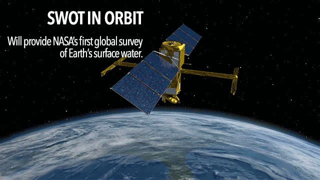
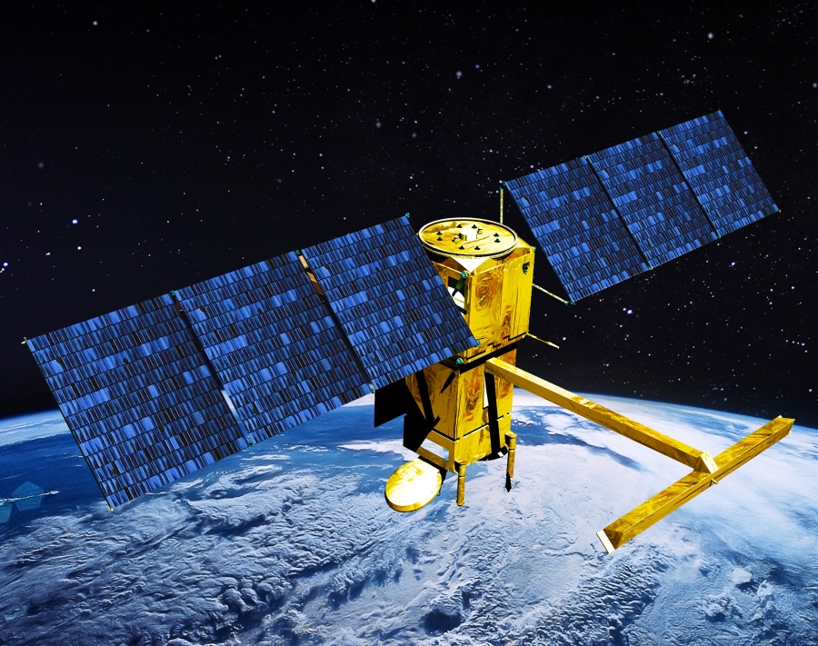
The SWOT Satellite
From the polar orbit where the Falcon 9 will drop it, SWOT will be capable of observing about 90 % of Earth’s surface water. This is due to the fact that the orbital inclination will not allow the satellite to reach the most extreme latitudes — i.e., the poles. Additionally, some water bodies or flows will be smaller than what the eyes of the spacecraft will be able to see. Nevertheless, the scale of the global survey will still be unprecedented. In order to fulfill this job, SWOT was designed featuring systems and payloads that will ensure it is mission-capable.

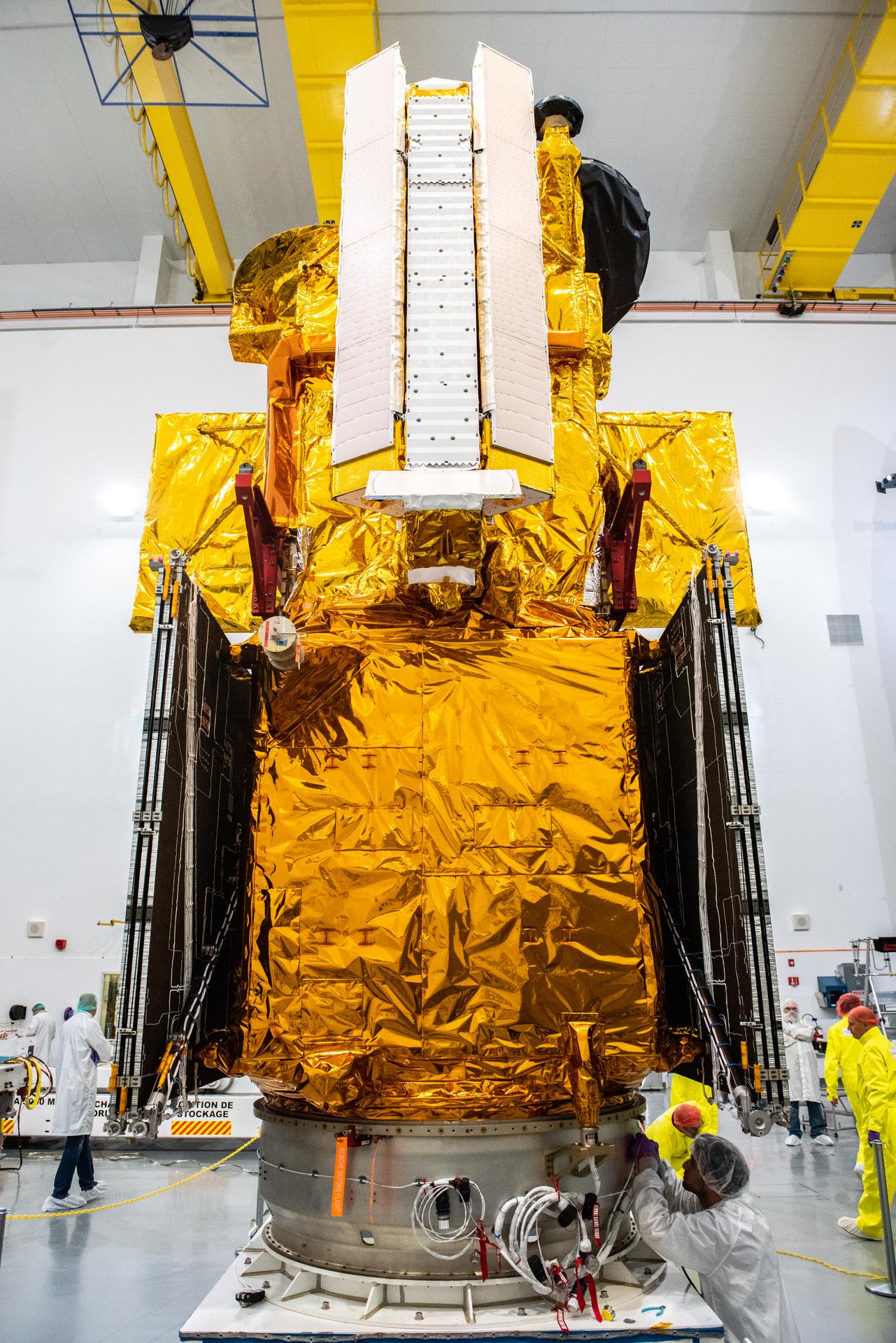
SWOT is about 5 m (16.4 ft) tall with a 14.9 m (48.8 ft) span when the solar arrays are deployed. These feature a total surface area of 31 m2 (335 ft2), and the whole spacecraft masses at 2,200 kg (4,850 lb). Structurally, it is subdivided into two main assemblies: the payload module and the spacecraft bus. The former, where all the instruments live, was developed by the NASA Jet Propulsion Laboratory (JPL). The latter, which is tasked with hosting electronics needed for the flight, and for science, as well as attitude and orbit control systems, was entrusted to Thales Alenia Space by the CNES.
Payload Module
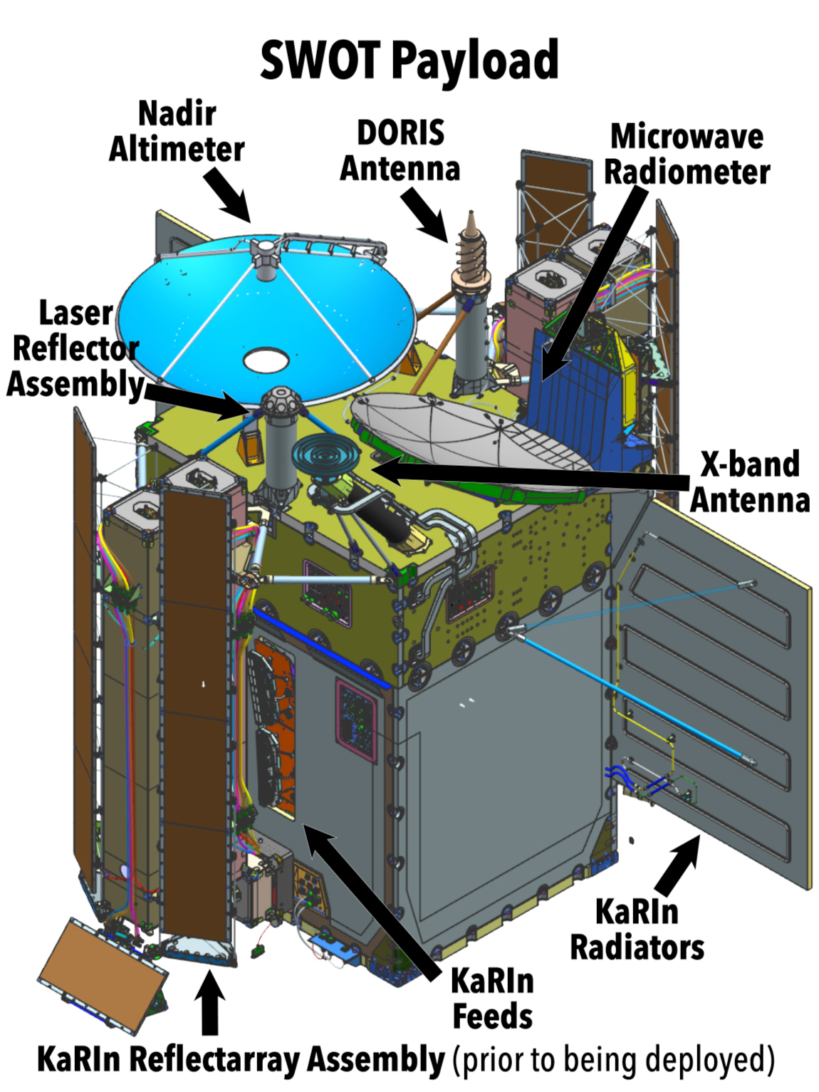
With the satellite already in orbit, its lower half will be the payload module, allowing for a clear view of Earth.
Jason-Class Altimeter
This is a heritage instrument developed by Thales Alenia, which will be placed in the nadir position — i.e., facing directly to the ground below — in order to measure sea surface height. Electromagnetic beams traveling up and down to and from this payload will reach the Earth right between both of KaRIN’s swaths, and will help in determining orbital altitude.
X-Band Antenna
Assembled at JPL from components with a flight history, it will be in charge of the high-rate data downlink. By requirement, SWOT will use it to connect via two signals with CNES’s ground stations.
DORIS Antenna
Meaning Doppler Orbitography and Radiopositioning Integrated by Satellite, this receiver antenna was developed by CNES. Its purpose consists of detecting signals from 50 to 60 radio beacons, a French system allowing for precise orbit demonstration in ocean altimetry missions. Once again, this instrument’s design stands on the shoulders of previous developments for the NASA-CNES long ongoing collaboration.
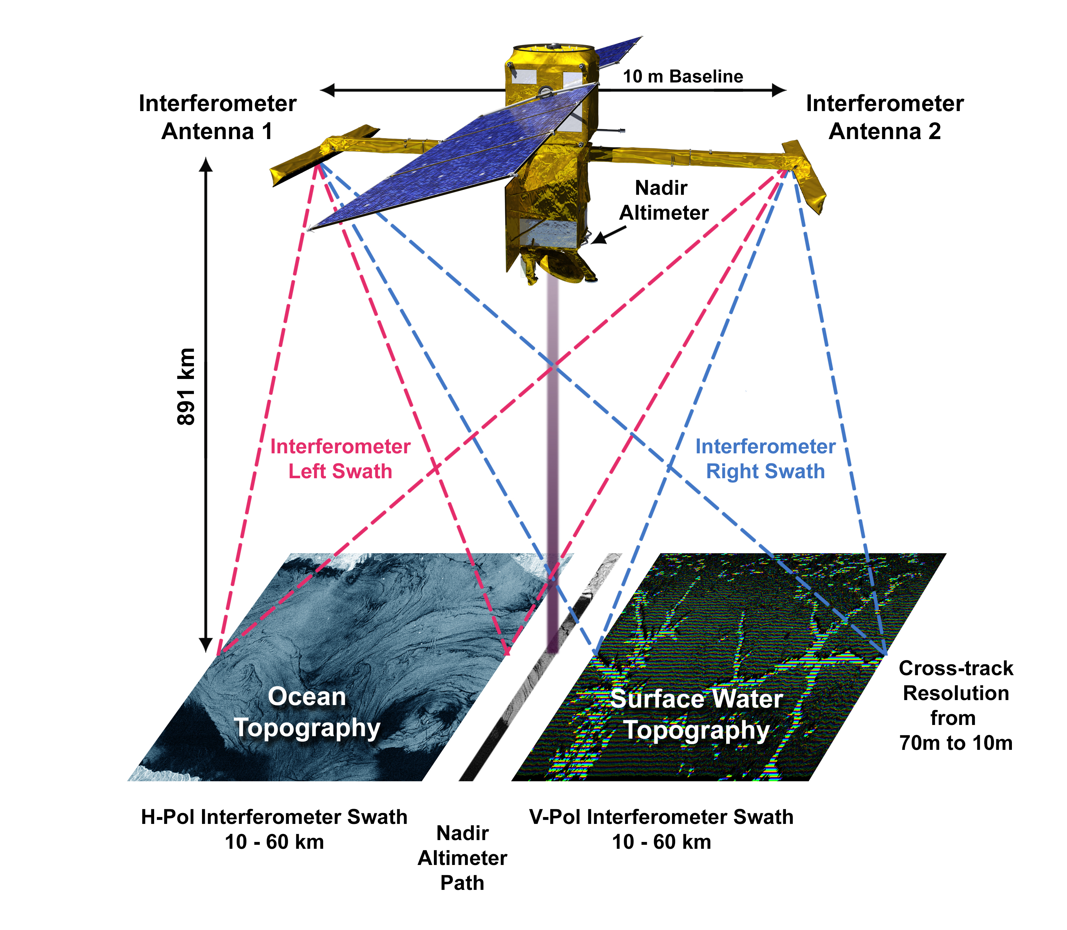
KaRIN
The Ka-band Radar Interferometer is SWOT’s main instrument, capable of carrying out altimetry with a height precision in the order of 1 cm (0.4 in), over two swaths 120 km (75 mi) of total width. These will be apart from one another at a 20 km (12 mi) distance.
Radar pulses will come from the KaRIN feeds on one side of the module, and one of the reflectarray assemblies will redirect the signal toward the ground. In a continuing alternation, one pulse will go to one swath-half, and the next to the other half. For each half a different polarization is used. Radar waves bounce back from the ground and are detected by both reflectarrays. These, in turn, redirect them to the satellite’s body, to be sensed.
This instrument has been developed by the JPL, taking into consideration much of the experience gained through the past missions mentioned in the brief history in this article. An Extended Interaction Klystron will be provided by CSA via its contractor, Communications and Power Industries. Its function is to help KaRIN achieve high peak powers — 1,500 Watts in radio frequency energy — and efficiency.
Microwave Radiometer
As water vapor delays radar interferometer signals, an advanced microwave radiometer is used to correct for the presence of said substance mainly in the troposphere. This is another development of the JPL, similar to instruments flying in Jason missions.
Laser Reflector Assembly
It consists of an array of mirrors developed by the JPL, which work together as a target for ground-based tracking observatories. These stations will shoot laser beams to the satellite, allowing for a precise orbit determination, and positively impacting SWOT’s measurement accuracy.
Global Positioning System (GPS) Receiver
Based on TriG, the best on NASA’s space science position Global Positioning System receivers, it will aid in accurate orbital determination. To do so, this JPL development picks up GPS signals.
Spacecraft Bus
It is the platform governing flight and providing energy for the payload half, which can be roughly described through the following subsystems or components:
- S-Band Antenna: allowing for communications spacecraft-ground.
- Command and Data Handler: consisting of a centralized processor and featuring storage capabilities, it will manage SWOT’s communications link.
- Electrical Power: it generates, stores, and distributes energy to the whole satellite.
- Thermal Control: managing heat exchange, this subsystems keeps each part or instrument on the spacecraft within operational temperatures.

- Solar Arrays: deployed on each side of the bus, they will remain pointed at the Sun by means of small drive motors.
- Attitude Control: using start trackers it will determine how SWOT is oriented, correcting if necessary via magnetic torquer bars and reaction wheels.
- Propulsion: including eight onboard thrusters which produce 22 N (4.9 lbf) of thrust, and the largest membrane-type tank, storing hydrazine. After “end of mission,” it will be used to deorbit the satellite, limiting space debris generation, and the probability of falling onto populated areas.
What Is Falcon 9 Block 5?
The Falcon 9 Block 5 is SpaceX’s partially reusable two-stage medium-lift launch vehicle. The vehicle consists of a reusable first stage, an expendable second stage, and, when in payload configuration, a pair of reusable fairing halves.
First Stage
The Falcon 9 first stage contains 9 Merlin 1D+ sea level engines. Each engine uses an open gas generator cycle and runs on RP-1 and liquid oxygen (LOx). Each engine produces 845 kN of thrust at sea level, with a specific impulse (ISP) of 285 seconds, and 934 kN in a vacuum with an ISP of 313 seconds. Due to the powerful nature of the engine, and the large amount of them, the Falcon 9 first stage is able to lose an engine right off the pad, or up to two later in flight, and be able to successfully place the payload into orbit.
The Merlin engines are ignited by triethylaluminum and triethylborane (TEA-TEB), which instantaneously burst into flames when mixed in the presence of oxygen. During static fire and launch the TEA-TEB is provided by the ground service equipment. However, as the Falcon 9 first stage is able to propulsively land, three of the Merlin engines (E1, E5, and E9) contain TEA-TEB canisters to relight for the boost back, reentry, and landing burns.
Second Stage
The Falcon 9 second stage is the only expendable part of the Falcon 9. It contains a singular MVacD engine that produces 992 kN of thrust and an ISP of 348 seconds. The second stage is capable of doing several burns, allowing the Falcon 9 to put payloads in several different orbits.
For missions with many burns and/or long coasts between burns, the second stage is able to be equipped with a mission extension package. When the second stage has this package it has a grey strip, which helps keep the RP-1 warm, an increased number of composite-overwrapped pressure vessels (COPVs) for pressurization control, and additional TEA-TEB.
Falcon 9 Booster
The booster supporting the SWOT mission was B1071, which had supported five previous flights. Hence, its designation for this mission was B1071-6; this changed to B1071-7 after successful landing.
| B1071’s missions | Launch Date (UTC) | Turnaround Time (Days) |
| NROL-87 | February 2, 2022 20:27 | N/A |
| NROL-85 | April 17, 2022 13:13 | 73.70 |
| SARah 1 | June 18, 2022 14:19 | 62.05 |
| Starlink Group 3-2 | July 22, 2022 17:39 | 33.14 |
| Starlink Group 4-29 | October 03, 2022 23:56 | 73.26 |
| SWOT | December 16, 2022 11:46 | 71.52 |
Following stage separation, the Falcon 9 conducted three burns. These allowed to softly touch down the booster on SpaceX’s landing pad Landing Zone 4.

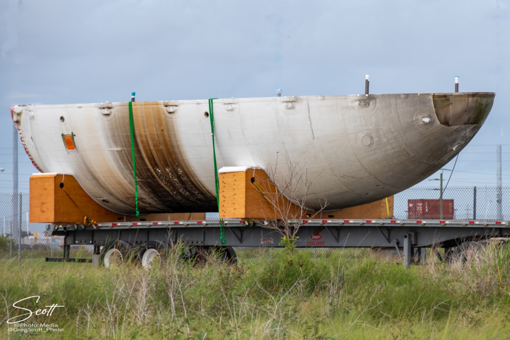
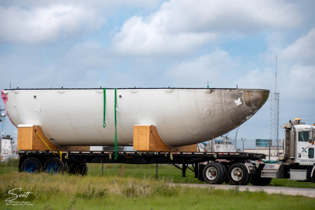
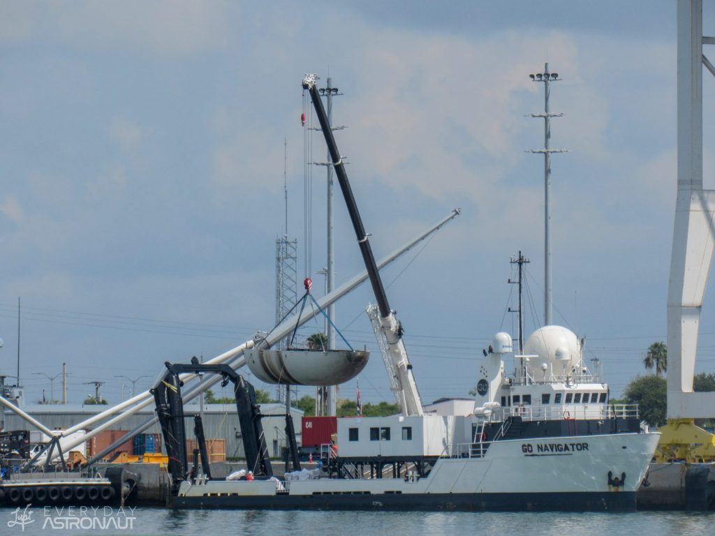
Falcon 9 Fairings
The Falcon 9’s fairing consists of two dissimilar reusable halves. The first half (the half that faces away from the transport erector) is called the active half, and houses the pneumatics for the separation system. The other fairing half is called the passive half. As the name implies, this half plays a purely passive role in the fairing separation process, as it relies on the pneumatics from the active half.
Both fairing halves are equipped with cold gas thrusters and a parafoil which are used to softly touch down the fairing half in the ocean. SpaceX used to attempt to catch the fairing halves, however, at the end of 2020 this program was canceled due to safety risks and a low success rate. On SWOT, SpaceX successfully recovered the fairing halves from the water with their recovery vessel NRC Quest.
In 2021, SpaceX started flying a new version of the Falcon 9 fairing. The new “upgraded” version has vents only at the top of each fairing half, by the gap between the halves, whereas the old version had vents placed spread equidistantly around the base of the fairing. Moving the vents decreases the chance of water getting into the fairing, making the chance of a successful scoop significantly higher.
SWOT Countdown
All times are approximate
| HR/MIN/SEC | EVENT |
|---|---|
| 00:38:00 | SpaceX Launch Director verifies go for propellant load |
| 00:35:00 | RP-1 (rocket grade kerosene) loading underway |
| 00:35:00 | 1st stage LOx (liquid oxygen) loading underway |
| 00:16:00 | 2nd stage LOx loading underway |
| 00:07:00 | Falcon 9 begins engine chill prior to launch |
| 00:01:00 | Command flight computer to begin final prelaunch checks |
| 00:01:00 | Propellant tank pressurization to flight pressure begins |
| 00:00:45 | SpaceX Launch Director verifies go for launch |
| 00:00:03 | Engine controller commands engine ignition sequence to start |
| 00:00:00 | Falcon 9 lift-off |
LAUNCH, LANDING, AND DEPLOYMENT
All times are approximate
| HR/MIN/SEC | EVENT |
|---|---|
| 00:01:12 | Max Q (moment of peak mechanical stress on the rocket) |
| 00:02:16 | 1st stage main engine cutoff (MECO) |
| 00:02:20 | 1st and 2nd stages separate |
| 00:02:27 | 2nd stage engine starts |
| 00:02:33 | Boostback burn start |
| 00:02:58 | Fairing deployment |
| 00:03:28 | Boostback burn complete |
| 00:06:02 | 1st stage entry burn start |
| 00:06:14 | 1st stage entry burn complete |
| 00:07:06 | 1st stage landing burn start |
| 00:07:35 | 1st stage landing |
| 00:08:24 | 2nd stage engine cutoff (SECO-1) |
| 00:43:22 | 2nd stage engine starts (SES-2) |
| 00:43:27 | 2nd stage engine cutoff (SECO-2) |
| 00:52:28 | SWOT deploys |