


Featured image credit: Xinhua
Lift Off Time | April 29, 2022 – 00:11 EDT | 12:11 BJT |
|---|---|
Mission Name | SuperView Neo 1-01 & 02, two commercial remote sensing satellites |
Launch Provider | China Aerospace Science and Technology Corporation (CASC) |
Customer | China Siwei Survey and Mapping Technology Co. Ltd. |
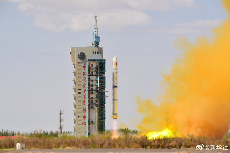
Rocket | Long March 2C |
Launch Location | Launch Area 4 (SLS-2 / 603), Jiuquan Satellite Launch Center, People’s Republic of China |
Payload mass | ~1,080 kg |
Where did the satellites go? | Sun-Synchronous Orbit (SSO) |
Did they attempt to recover the first stage? | No, this is not capability of Long March 2C |
Where did the first stage land? | It crashed on land in mainland China |
Did they attempt to recover the fairings? | No, this is not capability of Long March 2C |
Were these fairings new? | Yes |
This was the: | – 44th orbital launch attempt of 2022 (43rd successful) – 61st launch of Long March 2C – 417th flight of the Long March series |
Where to re-watch | If available, a replay will be listed here |
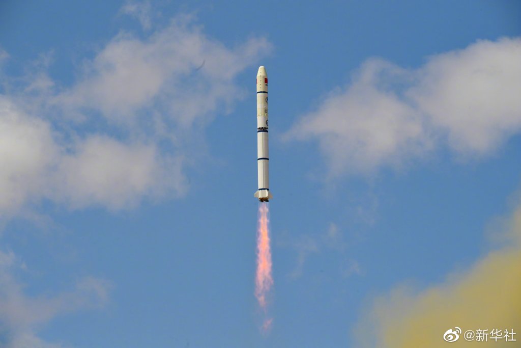
How Did It Go?
The China Aerospace Science Corporation (CASC) successfully launched the SuperView Neo 1-01 & 02 commercial remote sensing satellites into SSO. The satellites were carried by the Long March 2C rocket, from Jiuquan Satellite Launch Center, in China.
SuperView Neo 1-01 & 02 Mission
The SuperView Neo 1-01 & 02 satellites were designed and manufactured by the China Association for Science and Technology (CAST) for China Siwei Survey and Mapping Technology Co. Ltd. (China Siwei), a leading company providing geospatial information services in China.
The company is developing a SuperView Neo satellite system, a successor of the existing SuperView-1 constellation. The SuperView Neo constellation will include at least 28 satellites of 3 series. The first one is called SuperView Neo-1 and it aims to provide 20 to 30 cm optical images. SuperView Neo-2 will produce synthetic-aperture radar (SAR) images with 50 cm resolution in spotlight mode, whereas SuperView Neo-3 will acquire large swath-width optical images with resolution higher than 1 meter.
On this mission, two satellites of the first series (SuperView Neo-1) were launched. These satellites have a mass of 540 kg each, with resolution down to 0.3 meters.

The satellites will mainly provide remote sensing data services for domestic industries, including resource and environment monitoring and management, surveying and mapping, emergency management, and others. Moreover, they aim at the emerging market such as smart agriculture, urban information model, and intelligent transportation.
Long March 2C
The Long March 2C is a two stage medium-lift launch vehicle, with an optional third stage, derived from China’s Long March 2B vehicle. It is able to put up to 3,850 kg into low-Earth orbit, and up to 1,250 kg into geostationary transfer obit (GTO).
First Stage
The first stage has 4 open cycle YF-21C engines. Each engine runs on dinitrogen tetroxide (N2O4) and unsymmetrical dimethylhydrazine (UDMH), producing 740 kN of thrust each, with a specific impulse (ISP) of 260 seconds. Overall, the first stage produces 2,960 kN of thrust and carries 182,000 kg of propellant. The first stage is 25.72 meters tall, and 3.35 meters in diameter.
Second Stage
The second stage runs on a single YF-24E engine, which contains 1 main YF-22E engine for thrust, and 4 YF-23C attitude control thrusters. The main engine produces 816 kN of thrust and the attitude control thrusters each produce 47 kN, and both run on N2O4 and UDMH. The main engine’s ISP is ~300 seconds, and the attitude control thrusters have an ISP of 289 seconds. The second stage is 7.75 meters tall, 3.35 meters in diameter, and carries 162,700 kg of propellant.
Third stage
The third stage, the Yuanzheng, is a restartable upper stage. The variant used on the Long March 2C is designated YZ-1S. The Yuanzheng allows launch vehicles to deploy their payloads directly into high energy orbits, like medium-Earth orbit (MEO) and geosynchronous orbit (GSO). The stage features one YF-50D engine, which like the first and second stages runs UDMH and N2O4. It provides 6.5 kN of thrust and has an ISP of 315.5 seconds. The stage can perform at least two burns within its lifespan of 6.5 hours.

Rocket section by Trevor Sesnic.
A boundary survey is a means of defining the limits of a property formally. It mainly focuses on the definition of the corners of a plot. People usually perform boundary surveys before they buy, split, improve or build on the land. A land surveyor will create a drawing once a boundary survey is complete. The professional conducts the survey because measurements must be as accurate as possible. The survey begins with the measurement, marking and mapping of the boundary lines of land ownership.(http://www.scondesign.in/our-services/civil-engineering-companies-bangalore/survey-companies-bangalore/boundary-survey-companies-bangalore/) The surveyor then scrutinizes the historical records of the purchased property as well as the lands around it.This is done to make sure that the buyer has more proof of limits, which in the long term can be very helpful. Also, the boundary surveyor in Edmond may talk to previous owners and ad-joiners.After the research, field work starts and involves the establishment of a control network of known crossing points. The points are used for the search and location of existing construction and other boundary evidence. While the field portion of a survey is the most visible survey phase, it usually accounts for only a third of the whole project.
The results of the field work will be compared to the research, and the surveyor will then reconcile all the information to conclude the limits. The surveyor will finally produce a plan and produce a legal description and report.